Mount Sabyinyo: Three Countries, One Mountain
The calm before the 8 hour hike.
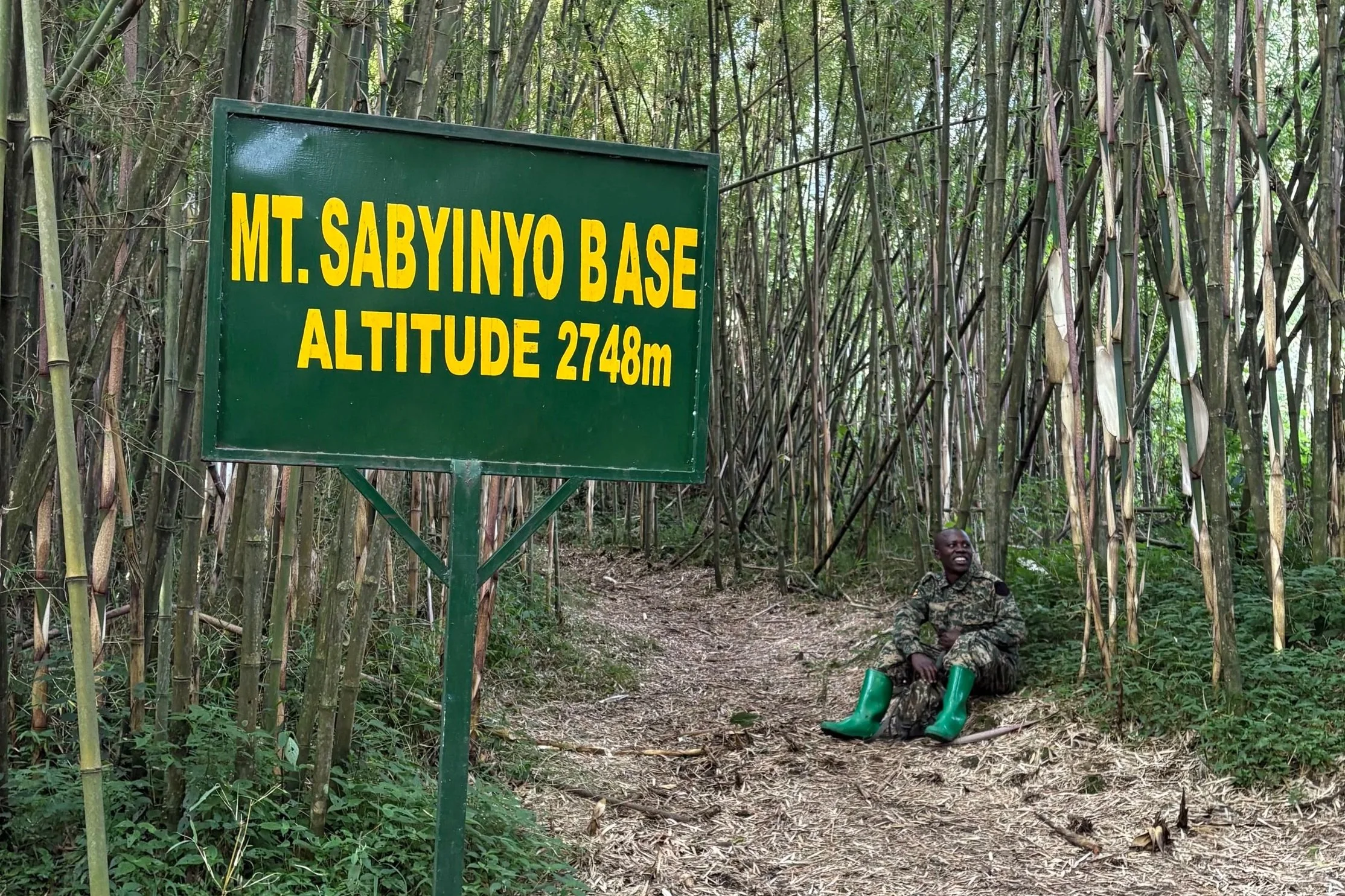
An 8-hour hike to Uganda, Rwanda, and the DRC
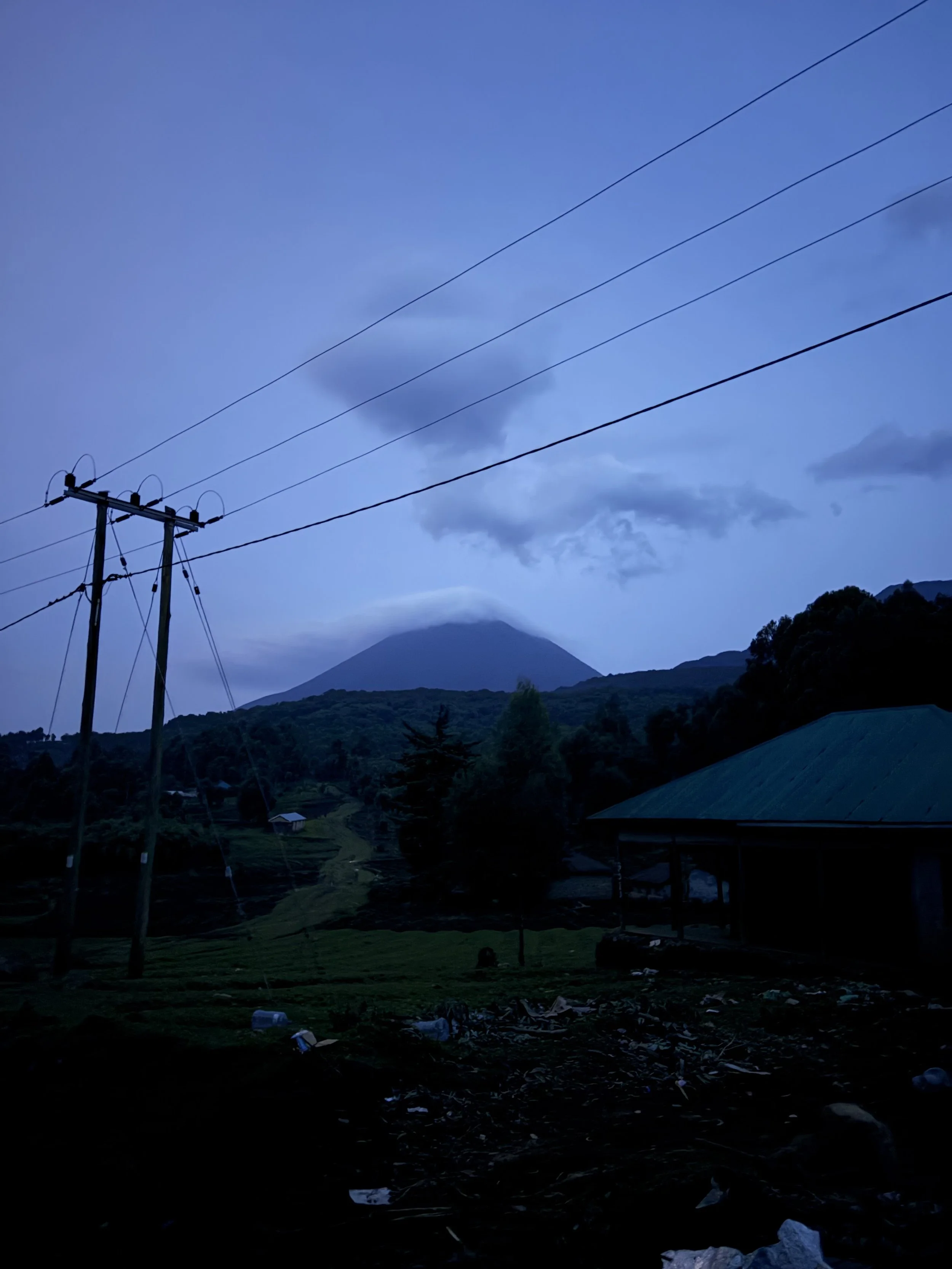
Somewhere under these clouds was the summit I’d reach tomorrow.
I’m at the Rwandan-Ugandan border, and already I can see the difference between the countries. The orderly streets and brick-and-mortar shops of Rwanda seem a world away from the unpaved red-dirt roads and people yelling from stalls at every turn just across the way. I’m climbing into the back of a taxi bound for a hike in Mgahinga National Park. The hike in Rwanda gave me a bit of my confidence back, and this seems like a good opportunity to put it to the test. But getting there is a journey in itself. I have to switch from the taxi to a minibus. Go through winding mountain roads and police checkpoints. And when I get to the closest town I can be, there’s still a 30-minute motorbike ride to the lodge. I settle in behind the driver, tighten my backpack straps, and we start riding up a dirt road filled with rocks and holes, leaving my legs and abs burning as I try to stay seated while the driver swerves to avoid people, cows, and other obstacles. When we get to the lodge, and I peel my fingers off one by one, the sun sets and night falls like a curtain on the mountain, bringing the cold and the realization that I’m not nearly prepared enough for this hike. With no water, food, or clothes meant for the biting wind and lower temperatures I’ll face tomorrow, I have to walk back down the path to try to look through the trading villages and hope I can find the things I need for tomorrow. The darkness only deepens, and soon I can’t see five feet in front of me. With my legs already tired and my mind even more so, I don’t want to risk twisting an ankle while I drag my feet. I give up and retrace my steps back to the lodge and my tent as I climb into my sleeping bag and collapse for tomorrow.

Three countries, one mountain and not much left in my legs.
At 8 a.m. sharp the next morning, I’m meeting the guide and the rangers as they check in to make sure I’m prepared and we get started. Just twenty minutes into this planned 8-hour hike. (I know I set a timer to track it), my guide’s breath is already steaming in the cold mountain air behind me. Then, ten minutes later, when we reach the base to take a break before the real hike starts, he’s nowhere to be found. We’ve left him behind. That should’ve been my first indication that I might’ve been too eager to get back on a mountain, but I can’t wait all day if I want to make it up and down this mountain, and with only one day here, there was no way I was turning back. We make good progress on the first two peaks despite the many, many breaks I need, taking only a few hours to cover each. The day begins to warm up as the sun rises, offering us a view of the countryside as the villages and towns stretch out and dot the land far below. It’s after the lunch break, when we’re getting ready to reach the third and final peak, that yesterday’s bike ride really starts to weigh on me. I try to stand just to feel my legs wobble a bit, but turning back now, when I’m so close, isn’t even an option. I think to myself, it’s only one more peak before we’re setting off, so I do my best to push it out of my mind and push myself up this mountain. Little did I know that this peak would be the hardest by far. We start off going up, up, up. It’s so steep here that they’ve had to install steps and ladders into the path so you can make your way up safely. 574 of them at least, and that was me, starting the count more than halfway up, when the fire in my legs became so consuming that I had to take my mind off it or risk sitting down for a respite and not getting back up. But I take those last few steps to reach the top, and it pays off, because now I’m standing at the top of not just one but three countries at once. The final, highest peak of Mt. Sabyinyo rises in Uganda, Rwanda, and the DRC, letting you look across each one. 12,037 feet in under five hours, and as I walk between them, three countries in under thirty seconds. Each time I turn my head, I’m looking out over a different country. Borders don’t exist up here, and I hop around all three countries, taking it in and what I’ve just managed to accomplish.
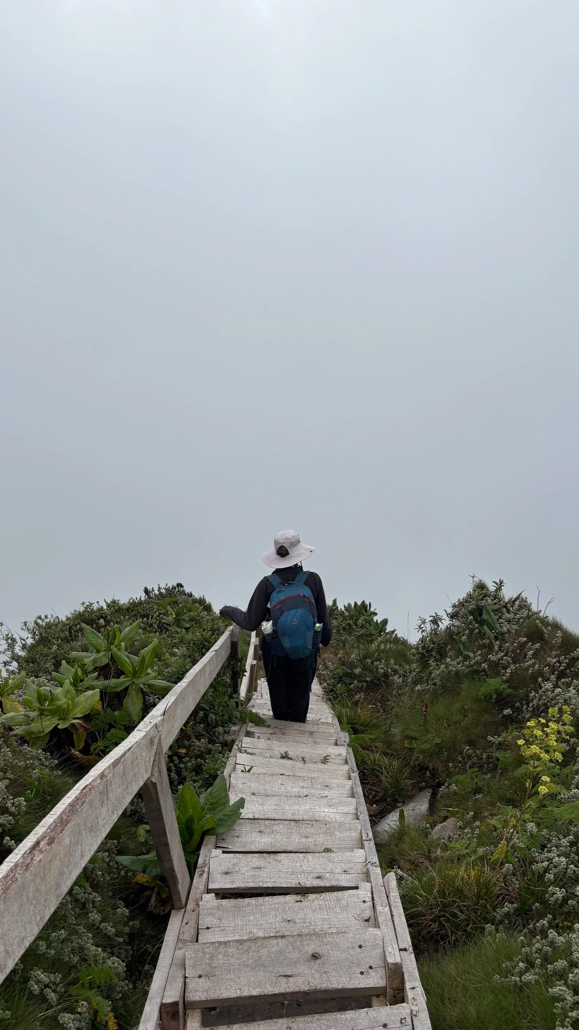
The view disappeared but the stairs didn’t.
Deep breaths. I take it all in one last time before the ranger says it’s time to descend. And it’s at that very moment that a fog rolls in thicker than a winter blanket. Where I was just looking out for miles and miles, I now can’t see more than a few feet in front of me. I reach the top of the steps and stare down. They disappear into the clouds as the ranger fades from view. There’s only one way to go and with him out of sight I can’t do anything but take more deep breaths and put my foot on the step I can see and trust that if I got up, I can get back down too. It’s nerve-wracking going down something that was so clear just a few minutes ago, and with the fog, the steps are wet with condensation. It’s slow going, but I have no plans to slip off the mountain, so I turn my focus ahead, putting one foot in front of the other, trying not to lose my balance and catch glimpses of the ranger ahead of me. A few minutes later, and I can see the rest stop at the top of the second peak coming into view through the fog like a lighthouse for weary ships. As I approach the rest stop on the second peak, I see none other than the guide we left behind. He’s all smiles and laughs as he sees how weary I am before I plop down onto the ground and take a long drink of water that ends up spilling more on the ground than into my mouth.
The fog has spooked the ranger, and he tells us we have to move much faster since rain can’t be far behind. He stands up to signal that we’re moving out and then takes off at a pace that I’m nearly running to keep up with. I can feel the cold, clammy air seeping through my jacket, dampening my shirt and sticking to my skin. The cold, crisp air burns my nostrils as I huff with exertion, trying to catch my breath and keep the guide in my sight at the same time. We’re making great progress though, despite my legs calling out for help as new muscles start to burn, and before I know it, we’ve reached the halfway point on the mountain. Now, we’ve slowed down to a much more reasonable pace since we’re so close, and the rest of the hike is easy going, and my thighs are thankful for it. It’s still a brisk pace, but not nearly as fast as it was when we were coming down, and only a few hours later, I’m seeing the office at the entrance to Mgahinga National Park. By now, I want nothing more than to get back to my sleeping bag, but there’s still a whole ceremony left to do. They give out a certificate for conquering the mountain, but the only reward I want is to sit down, or better yet, lie down and take a long nap.
Book that’s currently distracting me from writing my next blog post: The Race for Life: Memoirs of a Rwandan Genocide Survivor X Theo Makombe